Geoplus offers Very High-Resolution Imagery, AI-based GIS Analytical Services, and Satellite Imagery Derived Advanced Products.
OUR PARTNERS

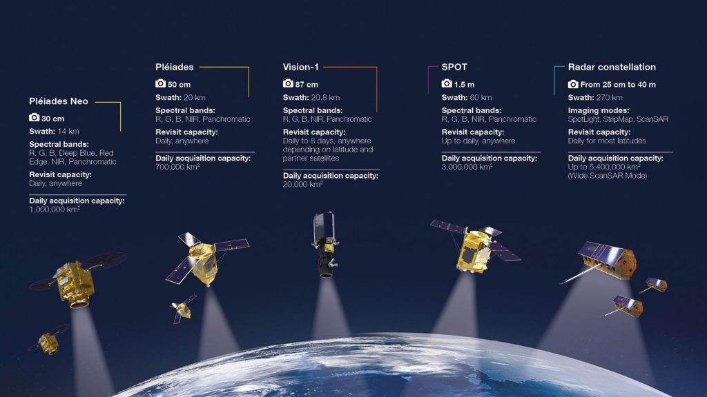
Airbus operates a powerful and versatile satellite constellation, integrating optical and radar capabilities for comprehensive Earth Observation.
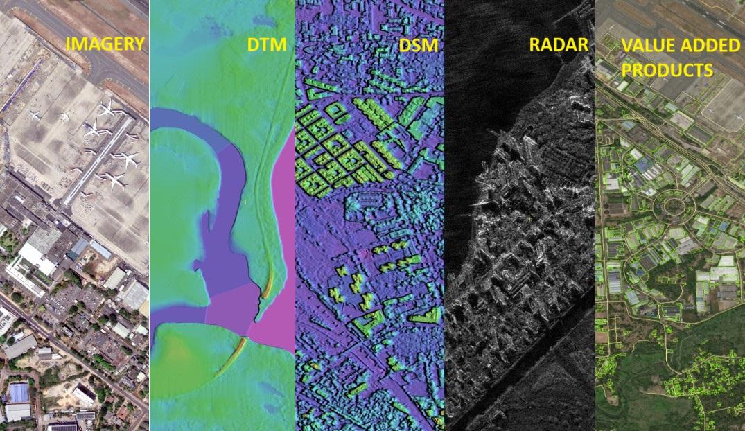
Our multi-sensor, multi-resolution and multi-source approach to data enables us to meet the diverse data needs of our customers, whether they require wide coverage, fine detail, intensive monitoring, high reactivity, timely acquisition regardless of lighting conditions or extensive archive data.
Derived from our first-class imagery, we also process a comprehensive portfolio of geospatial datasets, including high-quality elevation models, global layers, and grids.
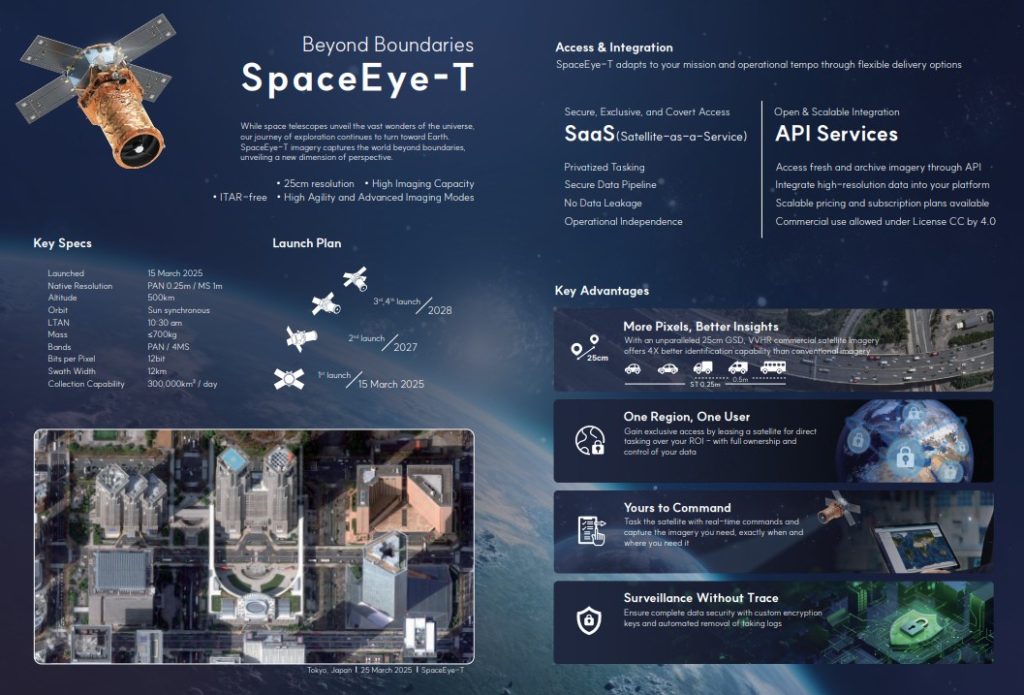
SI Imaging Services (SIIS) is a global provider of satellite imagery, specializing in commercial Earth observation data. SpaceEye-T is a high-performance commercial Earth observation satellite developed by Satrec Initiative Group with 100% proprietary technology and capital.
It features a native resolution of 25cm, a 12km swath width, and a weight of approximately 700kg. The satellite was successfully launched in March 2025 and is now operating under SI Imaging Services to observe the Earth.
More details

Beijing Aerospace World View Information Technology Co., Ltd. (“Aerospace World View”) was established in 2012. It is a wholly-owned subsidiary of China 4D Surveying and Mapping Technology Co., Ltd. under China Aerospace Science and Technology Corporation.